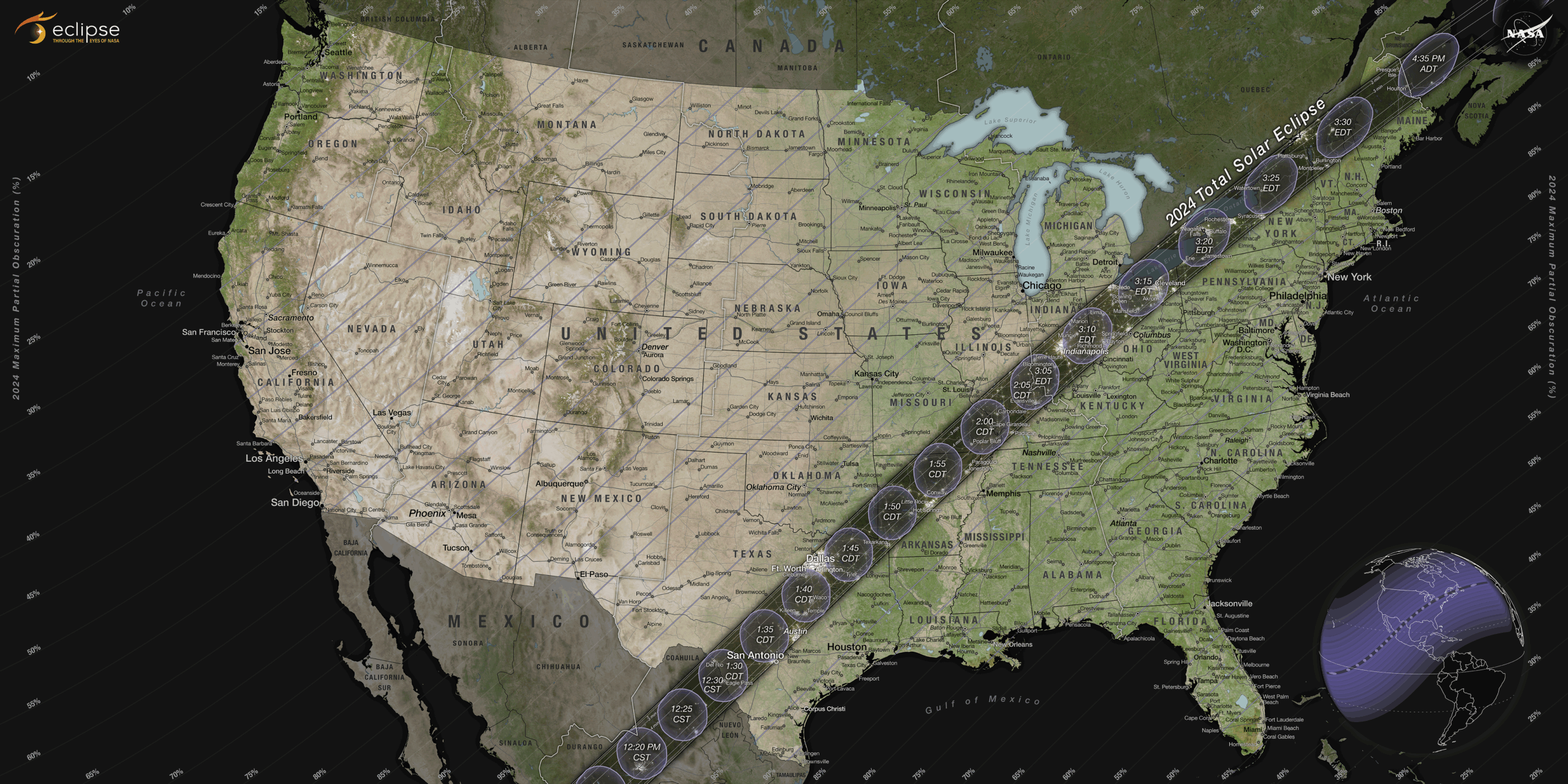
This map shows the path of the April 8 total eclipse across the United States, with times of greatest eclipse at selected locations. Skywatchers outside the path of totality will see a partial eclipse. The fraction of the Sun that will be blocked is indicated by blue diagonal lines. The small map at lower right shows the entire portion of the globe that will see at least a partial eclipse. A NASA website allows you to find details for your location. [NASA/Scientific Visualization Studio]
Find out more in our radio program entitled Total Eclipse.